Why Field Manager?

Geologic expertise
Developed by engineers and geologists for mining exploration. Includes free models and assistants for efficient data loading.
Technical Aspects

Geological mapping is fully digital, with exclusive tools, hand drawing over a high resolution image, topography or just using the device GPS or external DGPS, avoiding the geo-referencing working on each station.
Use standard styles of your company to uniform the mapping carried out by different geologist teams and merge maps easily.
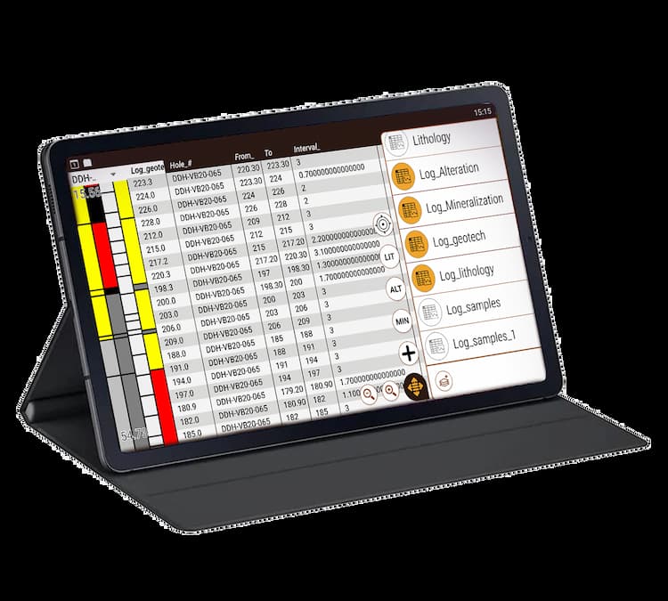
Logging under the company standards, codes and descriptions, avoiding the bias among different geologists. Field Manager includes multi-purpose built in tables, with the possibility to customize it to adapt to the company standards.
Avoid the typing errors, all the data is checked and standardized when acquired.


Save time by logging using a completely digital method. The acquired data can be uploaded immediately to the database. The graphic log is updated and visualized in real time.
When working on any device running Android 4.4 or higher, it is compatible with external GPS or DGPS, PXRF and drone (depending the model of external device).(Consult models)
It is compatible to import and export with the most commonly-used GIS file format, but not necessary to use a PC or laptop (tab, shp, sqlite, xls, kml, tiff, jpg, png, ecw, web map services and more).
All the Project data is available in the field, completely offline, easy to access, filtered, sorted and using thematic maps. Easily- downloaded high-resolution images can be used offline as a base map.

More Information
Some of the companies that rely in Field Manager
Explore Field Manager plans
Free Trial
30 days free for everyone.*- Unlimited use of the app for 30 days.
- Discover all the tools that Field Manager offers
Pro
Complete your campaigns with the license without data or usage restrictions. Convert your device into your most useful tool at a promotional price. Get:- Unlimited use of the app.*
- Support via email and WhatsApp.
- Training.
- Ability to dictate the direction of the project along with thousands of other users.
Enterprise
Customized solution for your company.- Personalized consulting.
- Service tailored to your needs.
- Adaptative support.
* No charges will be applied for data load and data usage in the app or number of users


